©Angela M. Lobefaro
DO NOT Download or use my photos without my written permission.
See you soon here dear Friends
16 June, 2009
We Definitely Need a Break
Sunny Afternoon

©Angela M. Lobefaro
DO NOT Download or use my photos without my written permission.
Shot taken in Camogli during Gadi's gadihext great 10 days visit with us in Italy! Thanks Gadi and Smadar for your kind visit!!
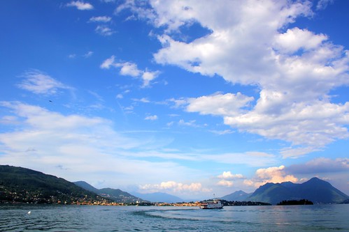
Camogli is a small Italian fishing village and tourist resort located in the province of Genoa on the Italian Riviera. Camogli has 5,692 inhabitants.
Small harbor in Camogli.
The name has a double meaning in Italian. The first translation, "houses close together", is apparent when strolling through the town's narrow streets, which are lined by tall columns of pastel-colored homes. The second meaning, "houses of wives", refers to the sea captains, sailors and fishermen's wives, who traditionally spent their time at home while their husbands were out at sea.
Camogli is located just at the basis of Monte di Portofino and guarantees a very special gastronomy tradition (focaccia in particular).
en.wikipedia.org/wiki/Camogli
15 June, 2009
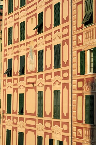
Camogli Patterns
©Angela M. Lobefaro
DO NOT Download or use my photos without my written permission.
Shot taken in Camogli during Gadi's gadihext great 10 days visit with us in Italy! Thanks Gadi and Smadar for your kind visit!!
Camogli is a small Italian fishing village and tourist resort located in the province of Genoa on the Italian Riviera. Camogli has 5,692 inhabitants.
Small harbor in Camogli.
The name has a double meaning in Italian. The first translation, "houses close together", is apparent when strolling through the town's narrow streets, which are lined by tall columns of pastel-colored homes. The second meaning, "houses of wives", refers to the sea captains, sailors and fishermen's wives, who traditionally spent their time at home while their husbands were out at sea.
Camogli is located just at the basis of Monte di Portofino and guarantees a very special gastronomy tradition (focaccia in particular).
en.wikipedia.org/wiki/Camogli
14 June, 2009
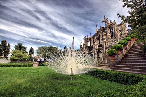
Benvenuti a Palazzo!
©Angela M. Lobefaro
DO NOT Download or use my photos without my written permission.
Shot taken by Max during Gadi's gadihext great 10 days visit with us in Italy! Thanks Gadi and Smadar for your kind visit!!
Isola Bella is one of the Borromean Islands of Lago Maggiore in north Italy. The island is situated in the Borromean Gulf 400 meters from the lakeside town of Stresa. Isola Bella is 320 meters long by 400 meters wide and is entirely occupied by the Palazzo Borromeo and its Italianate garden.
History
Until 1632 the island—known only as l’isola inferiore or isola di sotto[1]—was a rocky crag occupied by a tiny fishing village: but that year Carlo III of the influential House of Borromeo began the construction of a palazzo dedicated to his wife, Isabella D'Adda, from whom the island takes its name. He entrusted the works to the Milanese Angelo Crivelli, who was also to be responsible for the planning the gardens. The works were interrupted around middle of the century when the Duchy of Milan was struck by a devastating outbreak of the plague.
Construction resumed when the island passed to Carlo’s sons, Cardinal Giberto III (1615-1672) and Vitaliano VI (1620-1690); the latter in particular, with the financial backing of his elder brother, entrusted the completion of the works to the Milanese architect Carlo Fontana and turned the villa into a place of sumptuous parties and theatrical events for the nobility of Europe.
The completion of the gardens, however, was left to his nephew Carlo IV (1657 -1734). They were inaugurated in 1671.
The island achieved its highest level of social success during the period of Giberto V Borromeo (1751 – 1837) when guests included Edward Gibbon, Napoleon and his wife Joséphine de Beauharnais, and Caroline of Brunswick, the Princess of Wales. It is said that Caroline, having fallen in love with the place, did her best to convince the Borromeo family to sell her Isola Madre or the Castelli di Cannero islands; in the event she established herself on the banks of Lake Como at Cernobbio in the Villa d’Este.
en.wikipedia.org/wiki/Isola_Bella_(Lago_Maggiore)
13 June, 2009
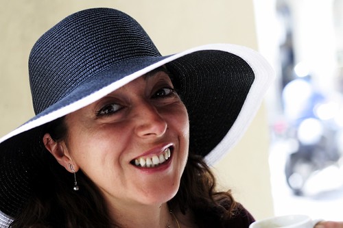
Happy New Hat!
©Angela M. Lobefaro
DO NOT Download or use my photos without my written permission.
Shot taken in Turin, during Gadi's gadihext great 10 days visit with us in Italy! Thanks Gadi and Smadar for your kind visit!!
High Hopes (in Turin)

©Angela M. Lobefaro
DO NOT Download or use my photos without my written permission.
Shot taken in Turin, during Gadi's gadihext great 10 days visit with us in Italy! Thanks Gadi and Smadar for your kind visit!!
01 June, 2009
Revolving Thoughts
© Angela M. Lobefaro
Thanks to gadihext and to his very friendly family for the fantastic hospitality!
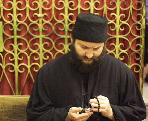
The Church of the Holy Sepulchre (Latin: Sanctum Sepulchrum), also called the Church of the Resurrection (Greek: Ναός της Αναστάσεως, Naos tis Anastaseos; Arabic: كنيسة القيامة, Kanīsat al-Qiyāma; Armenian: Սուրբ Հարություն, Surp Harutyun) by Eastern Christians, is a Christian church within the walled Old City of Jerusalem.
The site is venerated by most Christians as Golgotha,[1] (the Hill of Calvary), where the New Testament says that Jesus was crucified,[2] and is said to also contain the place where Jesus was buried (the sepulchre). The church has been an important pilgrimage destination since at least the 4th century, as the purported site of the death and resurrection of Jesus. Today it also serves as the headquarters of the Greek Orthodox Patriarch of Jerusalem, while control of the building is shared between several Christian churches and secular entities in complicated arrangements essentially unchanged for centuries.
en.wikipedia.org/wiki/Church_of_the_Holy_Sepulchre
Grotto Eyes

© Angela M. Lobefaro
Thanks to gadihext and to his very friendly family for the fantastic hospitality!
Rosh HaNikra ( [show location on an interactive map] 33°05′N 35°06′E / 33.083°N 35.1°E / 33.083; 35.1; Hebrew: ראש הנקרה, or Ras an-Naqoura, "head of the grottos") is a geologic formation in Israel, located on the coast of the Mediterranean Sea, in the Western Galilee near the border with Lebanon. It is a white chalk cliff face which opens up into spectacular grottos.
The Rosh HaNikra grottos are cavernous tunnels formed by sea action on the soft chalk rock. The total length is some 200 meters. They branch off in various directions with some interconnecting segments. In the past, the only access to them was from the sea and experienced divers were the only ones capable of visiting. Today a cable car takes visitors down to see the grottos. A kibbutz, also named Rosh HaNikra, is located nearby.
[edit] History
The Book of Joshua mentions "Misraphot Mayim" as a place south of Rosh HaNikra that was the border of the Israelite tribes of the time (13:6). Jewish sages referred to the cliff as "The Ladder of Tyre" (Hebrew: sullam Tzor).[citation needed] The site was later renamed A-Nawakir ("the grottos") after an Arab conquest. The present name, Rosh HaNikra, is a hebracized version of a latter dated Arabic variation "Ras-an-Nakura".
Throughout human history, Rosh HaNikra served as a passage point for trade caravans and armies between Lebanon, Syria, Israel, Egypt, and Africa. The British dug a tunnel through the nearby rocks for trains on what was the Cairo-Istanbul railway. A bridge was destroyed by Jewish underground fighters prior to 1948 during the operation Night of the bridges.
Rosh Hanikra was the site where Israeli and Lebanese officials negotiated and concluded an armistice in 1949 which ended the Lebanese-Israeli component of the 1948 War of Israeli Independence.
en.wikipedia.org/wiki/Rosh_HaNikra_grottoes
Subscribe to:
Posts (Atom)


