27 December, 2009
03 December, 2009
To Be or Not to be HIV-positive
>>>>>HIV, Pregnancy, Maternal and Child health<<<<<<
It has been estimated that 1.5 million HIV positive women become pregnant every year, which means that about 600,000 children are infected every year by vertical transmission. The figures from selected pre-natal clinics in urban areas reveal an incidence of HIV among pregnant women in sub-Saharan Africa of over 25%. In 2005, in LHDIC (Low Human Development Index Countries) only 9% of pregnant HIV-positive women received an antiretroviral prophylaxis to prevent transmission of the virus to their children, a modest increase of 3% compared with 2003. In these countries infection is associated with an increased risk of: spontaneous miscarriage, ectopic pregnancy, stillbirth, premature labour, premature rupture of membranes, urogenital infections, syphilis. In industrialized countries the incidence of vertical transmission of the virus has fallen to minimal levels, as low as 2%, thanks to the introduction of antiretroviral therapy, the use of Caesarean section, and artificial feeding. In Africa, instead, where these operations are not widespread and not always available and where breastfeeding for long periods is normal, the vertical transmission of the virus is still around 25 to 40%.
PMTCT (Prevention Mother to Child Transmission) and PPTCT PLUS (Parental Prevention to Child Transmission)
Vertical transmission can occur at various stages: during pregnancy, birth, or breastfeeding. In LHDIC the prevention of vertical transmission by seropositive mothers is achieved through diverse interventions including:
- Services to promote maternal and infant health (pre- and postnatal).
- Counselling and testing services. - Promotion of alternatives to breastfeeding and/or early interruption of the same.
- Optimized and non invasive obstetric procedures - Preventive antiretroviral therapy for the mother and child.
- Antimalarial prophylaxis, since it has been demonstrated to reduce vertical transmission.
It is important to guarantee all women access to counselling and to VCT (Voluntary Counselling Testing).
The breastfeeding stage is the most delicate and difficult to deal with. The WHO estimates that 94% of children in the world are breastfed. 79% continue to one year and 52% up to two years. Breastfeeding over six months is common in sub-Saharan Africa and in Asia. Without antiretroviral prophylaxis or other effective intervention to prevent the vertical transmission of HIV, breastfeeding that extends for two years or more can increase the risk of transmission of HIV by about 40%. About 5 to 20% of infants are infected in the post-natal period and the risk increases progressively with the duration of breastfeeding. However, the alternative to breastfeeding, artificial feeding, is recommended only where it is easy to guarantee the supply of powdered milk and clean drinking water. In LHDIC artificial feeding may lead to the development of very serious problems. Bearing in mind that regarding breastfeeding there are no unanimous and general recommendations and that every intervention depends on the operative context, it is advisable to abide by the strategies proposed by the Ministry of Health in each individual country, which in turn are derived from general recommendations of the WHO.
Case study: PMTCT and PPTCT PLUS in Zimbabwe
http://www.cesvi.eu/UserFiles/File/Hiv-Aids_Zimbabwe.def.pdf
Cover photos by Giovanni Diffidenti
.
DONATE NOW:
http://donazioni.cesvi.org/index-ing.asp
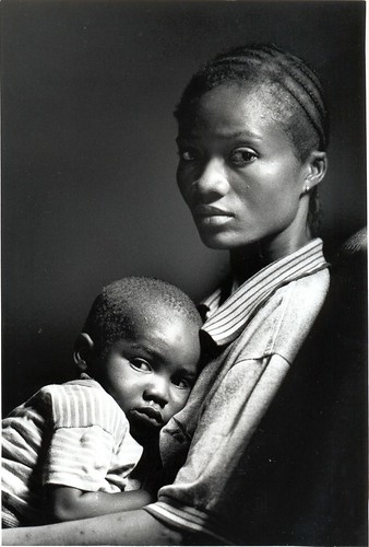
Uploaded by ! . © Angela Lobefaro . ! on 3 Dec 09, 12.35AM CET.
01 December, 2009
To Be or Not to be HIV-positive

on the left of this photo: Takunda
the first child born in Zimbabwe from a HIV-positive mother with the health program of Cesvi "Stop AIDS at Birth"
His name, written in Shona, means "We won", represents a winning solidarity and strength of a continent that can win the difficult battle against AIDS.
www.cesvi.eu/?pagina=pagina_generica.php&id=786
Hiv-Aids
>>>>>HIV, pregnancy, maternal and child health<<<<<<
It has been estimated that 1.5 million HIV positive women become pregnant every year, which means that about 600,000 children are infected every year by vertical transmission. The figures from selected pre-natal clinics in urban areas reveal an incidence of HIV among pregnant women in sub-Saharan Africa of over 25%. In 2005, in LHDIC (Low Human Development Index Countries) only 9% of pregnant HIV-positive women received an antiretroviral prophylaxis to prevent transmission of the virus to their children, a modest increase of 3% compared with 2003. In these countries infection is associated with an increased risk of: spontaneous miscarriage, ectopic pregnancy, stillbirth, premature labour, premature rupture of membranes, urogenital infections, syphilis. In industrialized countries the incidence of vertical transmission of the virus has fallen to minimal levels, as low as 2%, thanks to the introduction of antiretroviral therapy, the use of Caesarean section, and artificial feeding. In Africa, instead, where these operations are not widespread and not always available and where breastfeeding for long periods is normal, the vertical transmission of the virus is still around 25 to 40%.
PMTCT (Prevention Mother to Child Transmission) and PPTCT PLUS (Parental Prevention to Child Transmission)
Vertical transmission can occur at various stages: during pregnancy, birth, or breastfeeding. In LHDIC the prevention of vertical transmission by seropositive mothers is achieved through diverse interventions including:
- Services to promote maternal and infant health (pre- and postnatal).
- Counselling and testing services. - Promotion of alternatives to breastfeeding and/or early interruption of the same.
- Optimized and non invasive obstetric procedures - Preventive antiretroviral therapy for the mother and child.
- Antimalarial prophylaxis, since it has been demonstrated to reduce vertical transmission.
It is important to guarantee all women access to counselling and to VCT (Voluntary Counselling Testing).
The breastfeeding stage is the most delicate and difficult to deal with. The WHO estimates that 94% of children in the world are breastfed. 79% continue to one year and 52% up to two years. Breastfeeding over six months is common in sub-Saharan Africa and in Asia. Without antiretroviral prophylaxis or other effective intervention to prevent the vertical transmission of HIV, breastfeeding that extends for two years or more can increase the risk of transmission of HIV by about 40%. About 5 to 20% of infants are infected in the post-natal period and the risk increases progressively with the duration of breastfeeding. However, the alternative to breastfeeding, artificial feeding, is recommended only where it is easy to guarantee the supply of powdered milk and clean drinking water. In LHDIC artificial feeding may lead to the development of very serious problems. Bearing in mind that regarding breastfeeding there are no unanimous and general recommendations and that every intervention depends on the operative context, it is advisable to abide by the strategies proposed by the Ministry of Health in each individual country, which in turn are derived from general recommendations of the WHO.
Case study: PMTCT and PPTCT PLUS in Zimbabwe
www.cesvi.eu/UserFiles/File/Hiv-Aids_Zimbabwe.def.pdf
Cover photo by Giovanni Diffidenti
.
DONATE NOW:
donazioni.cesvi.org/index-ing.asp
27 November, 2009
21 November, 2009

07 November, 2009
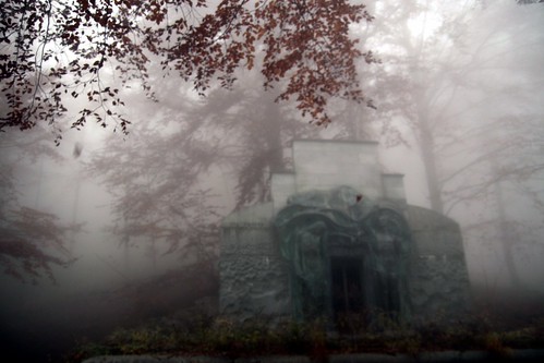
Ascension

Era un mattino buio e tempestoso ....
© Angela M. Lobefaro
All Rights Reserved
The Monumental Cemetery in the Sacred Mount of Oropa - Biella - Italy
Sacred Mount of Oropa
en.wikipedia.org/wiki/Sacro_Monte_di_Oropa
Oropa Sanctuary (Unesco World Heritage) in Biella - ( Piedmont ) Italy
Piedmont’s famous pilgrimage site. Madonna Nera (Black Holy Lady)
The sanctuary stands at the top of the woods and meadows of the Oropa Valley basin. Founded in 1620, the sanctuary spreads around three large squares and is both impressive and picturesque.
The First square is enclosed by two buildings from the 18th and 19th-centuries,. The Second square, standing on a higher level, has buildings designed between 1740-1750 by Francesco Gallo.
From the second square, take the long majestic flight of steps to reach the Holy Square, built in the 17th-century to designs by Pietro Arduzzi. Here the Ancient Basilica stands, built at the beginning of the 17th-century on the site of an earlier 2nd-century church. Inside is the so-called "Sacello Eusebiano" which houses the statue of the Madonna Nera (our Holy Black Lady) . This wooden sculpture covered in gold and gems dates back to the end of the 13th-century. According to legend it was brought to Oropa in the 3rd-century by the bishop of Vercelli, Eusebio.
Beyond the square rises the New Basilica built between 1885 and 1960. Completing the sanctuary are nineteen chapels that make up the Oropa Holy Mount. Of these, twelve were built between 1620 and 1720, and contain groups of sculptures depicting scenes from the life of the Madonna. The other seven, dispersed around the sanctuary, recount devotional episodes connected to Oropa.
www.piemonte-emozioni.it/cultura/eng/edifici_religiosi/sa...
05 November, 2009
02 November, 2009
01 November, 2009
One For All
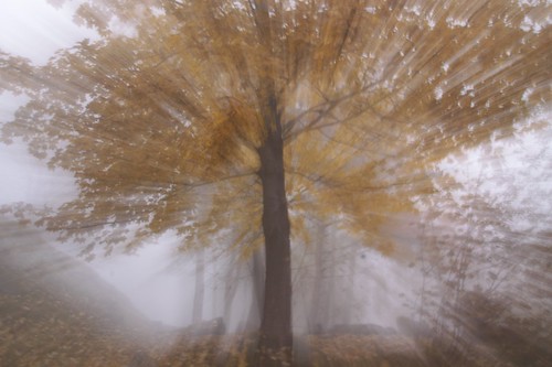
© Angela M. Lobefaro
All Rights Reserved
Oropa Sanctuary (Unesco World Heritage) in Biella - Italy
Piedmont’s famous pilgrimage site. Madonna Nera (Black Holy Lady)
The sanctuary stands at the top of the woods and meadows of the Oropa Valley basin. Founded in 1620, the sanctuary spreads around three large squares and is both impressive and picturesque.
The First square is enclosed by two buildings from the 18th and 19th-centuries,. The Second square, standing on a higher level, has buildings designed between 1740-1750 by Francesco Gallo.
From the second square, take the long majestic flight of steps to reach the Holy Square, built in the 17th-century to designs by Pietro Arduzzi. Here the Ancient Basilica stands, built at the beginning of the 17th-century on the site of an earlier 2nd-century church. Inside is the so-called "Sacello Eusebiano" which houses the statue of the Madonna Nera (our Holy Black Lady) . This wooden sculpture covered in gold and gems dates back to the end of the 13th-century. According to legend it was brought to Oropa in the 3rd-century by the bishop of Vercelli, Eusebio.
Beyond the square rises the New Basilica built between 1885 and 1960. Completing the sanctuary are nineteen chapels that make up the Oropa Holy Mount. Of these, twelve were built between 1620 and 1720, and contain groups of sculptures depicting scenes from the life of the Madonna. The other seven, dispersed around the sanctuary, recount devotional episodes connected to Oropa.
www.piemonte-emozioni.it/cultura/eng/edifici_religiosi/sa...
28 October, 2009
18 October, 2009
Ghost Bikers
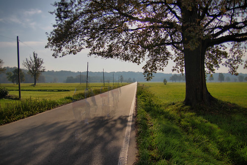
© Angela M. Lobefaro
All Rights Reserved
Max had to take a walk with the new camera...
his photo, my quick editing...
Baraggia, Piedmont, Italy
5 km from where we live
>>>>>>>>>>>HAVE A GREAT WEEK END!<<<<<<<<<<<<<<<
02 September, 2009
Oh Romeo, Oh Mio Romeo!
©Angela M. Lobefaro
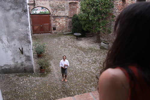
Our new Courtyard, and a friend ! (with good WINE)
-->>We are STILL unpacking, and arraging our new flat!
SOOOOOOOO much to do!!
See you soon Dear Friends!
06 August, 2009
Only You

©Angela M. Lobefaro
THE PLATTERS - ONLY YOU:
www.youtube.com/watch?v=9r2pEdc1_lI
Playing on the beach in Ko Chang - Thailand
..
please: DO NOT Download or use my photos without my written permission.
Dear Friends
we are back from our 3 weeks break!
We will not have so much time for comments...we are going to prepare to MOVE to another flat!
--
View on Dackr
Subscribe to my stream
31 July, 2009
The Jumping Pose
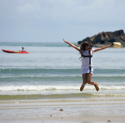
©Angela M. Lobefaro
Playing on the beach in Ko Chang - Thailand
please: DO NOT Download or use my photos without my written permission.
Dear Friends
we are back from our 3 weeks break!
We will not have so much time for comments...we are going to prepare to MOVE to another flat!
--
View on Dackr
Subscribe to my stream
30 July, 2009
Lunch is Ready
...Mind that: SAND FLIES were REALLY Busy: EATING US & everyone
©Angela M. Lobefaro
please: DO NOT Download or use my photos without my written permission.
Dear Friends
we are back from our 3 weeks break!
We will not have so much time for comments...we are going to prepare to MOVE to another flat!
--
View on Dackr
Subscribe to my stream
29 July, 2009
Angela No Limits
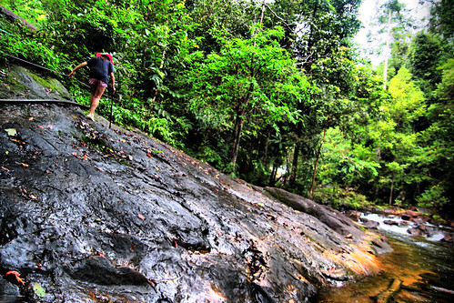
©Angela M. Lobefaro
Easy Walk in the Forest
as per descriptions they gave us:
"A walk for everybody"
?
alternative title: "SEMPRE PIU' IN ALTO" ( higher & higher)
26 July, 2009
AndreasC modeling for us ;-)
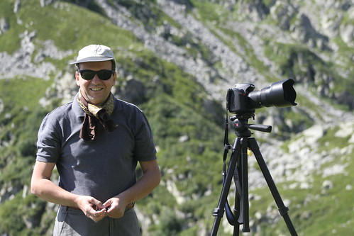
©Angela M. Lobefaro
AndreasC and his D700, straight from the camera
Todays we have spent a great day with bad_winters & AndreasC
at Lago del Mucrone (Lake Mucrone):
it.wikipedia.org/wiki/Lago_del_Mucrone
en.wikipedia.org/wiki/Lake_Mucrone
Thanks for your visit! Come back soon!
24 July, 2009

22 July, 2009
19 July, 2009
I am So Busy!
©Angela M. Lobefaro
please: DO NOT Download or use my photos without my written permission.
Dear Friends
we are back from our 3 weeks break!
We will not have so much time for comments...we are going to prepare to MOVE to another flat!
--
View on Dackr
Subscribe to my stream
18 July, 2009
16 July, 2009
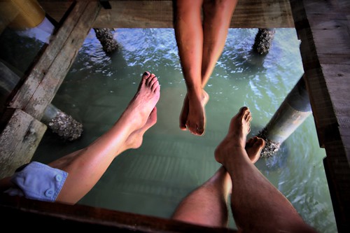
Free Foot Society
©Angela M. Lobefaro
please: DO NOT Download or use my photos without my written permission.
Dear Friends
we are back from our 3 weeks break!
We will not have so much time for comments...we are going to prepare to MOVE to another flat!
--
View on Dackr
Subscribe to my stream
taken in Bang Bao village - Koh Chang - Thailand
16 June, 2009
We Definitely Need a Break
©Angela M. Lobefaro
DO NOT Download or use my photos without my written permission.
See you soon here dear Friends
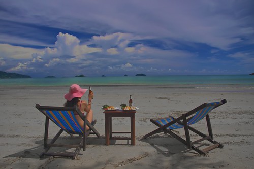
Sunny Afternoon

©Angela M. Lobefaro
DO NOT Download or use my photos without my written permission.
Shot taken in Camogli during Gadi's gadihext great 10 days visit with us in Italy! Thanks Gadi and Smadar for your kind visit!!
Camogli is a small Italian fishing village and tourist resort located in the province of Genoa on the Italian Riviera. Camogli has 5,692 inhabitants.
Small harbor in Camogli.
The name has a double meaning in Italian. The first translation, "houses close together", is apparent when strolling through the town's narrow streets, which are lined by tall columns of pastel-colored homes. The second meaning, "houses of wives", refers to the sea captains, sailors and fishermen's wives, who traditionally spent their time at home while their husbands were out at sea.
Camogli is located just at the basis of Monte di Portofino and guarantees a very special gastronomy tradition (focaccia in particular).
en.wikipedia.org/wiki/Camogli
15 June, 2009
Camogli Patterns
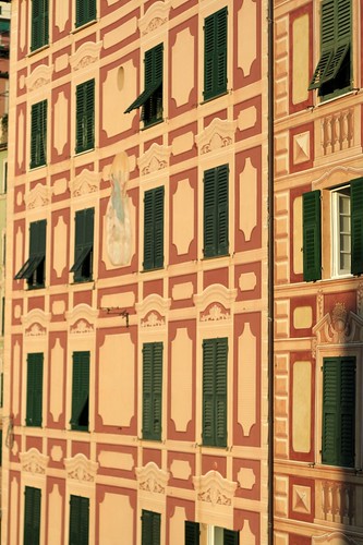
©Angela M. Lobefaro
DO NOT Download or use my photos without my written permission.
Shot taken in Camogli during Gadi's gadihext great 10 days visit with us in Italy! Thanks Gadi and Smadar for your kind visit!!
Camogli is a small Italian fishing village and tourist resort located in the province of Genoa on the Italian Riviera. Camogli has 5,692 inhabitants.
Small harbor in Camogli.
The name has a double meaning in Italian. The first translation, "houses close together", is apparent when strolling through the town's narrow streets, which are lined by tall columns of pastel-colored homes. The second meaning, "houses of wives", refers to the sea captains, sailors and fishermen's wives, who traditionally spent their time at home while their husbands were out at sea.
Camogli is located just at the basis of Monte di Portofino and guarantees a very special gastronomy tradition (focaccia in particular).
en.wikipedia.org/wiki/Camogli
14 June, 2009
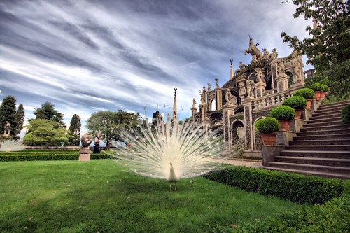
Benvenuti a Palazzo!
©Angela M. Lobefaro
DO NOT Download or use my photos without my written permission.
Shot taken by Max during Gadi's gadihext great 10 days visit with us in Italy! Thanks Gadi and Smadar for your kind visit!!
Isola Bella is one of the Borromean Islands of Lago Maggiore in north Italy. The island is situated in the Borromean Gulf 400 meters from the lakeside town of Stresa. Isola Bella is 320 meters long by 400 meters wide and is entirely occupied by the Palazzo Borromeo and its Italianate garden.
History
Until 1632 the island—known only as l’isola inferiore or isola di sotto[1]—was a rocky crag occupied by a tiny fishing village: but that year Carlo III of the influential House of Borromeo began the construction of a palazzo dedicated to his wife, Isabella D'Adda, from whom the island takes its name. He entrusted the works to the Milanese Angelo Crivelli, who was also to be responsible for the planning the gardens. The works were interrupted around middle of the century when the Duchy of Milan was struck by a devastating outbreak of the plague.
Construction resumed when the island passed to Carlo’s sons, Cardinal Giberto III (1615-1672) and Vitaliano VI (1620-1690); the latter in particular, with the financial backing of his elder brother, entrusted the completion of the works to the Milanese architect Carlo Fontana and turned the villa into a place of sumptuous parties and theatrical events for the nobility of Europe.
The completion of the gardens, however, was left to his nephew Carlo IV (1657 -1734). They were inaugurated in 1671.
The island achieved its highest level of social success during the period of Giberto V Borromeo (1751 – 1837) when guests included Edward Gibbon, Napoleon and his wife Joséphine de Beauharnais, and Caroline of Brunswick, the Princess of Wales. It is said that Caroline, having fallen in love with the place, did her best to convince the Borromeo family to sell her Isola Madre or the Castelli di Cannero islands; in the event she established herself on the banks of Lake Como at Cernobbio in the Villa d’Este.
en.wikipedia.org/wiki/Isola_Bella_(Lago_Maggiore)
13 June, 2009
Happy New Hat!
©Angela M. Lobefaro
DO NOT Download or use my photos without my written permission.
Shot taken in Turin, during Gadi's gadihext great 10 days visit with us in Italy! Thanks Gadi and Smadar for your kind visit!!
High Hopes (in Turin)

©Angela M. Lobefaro
DO NOT Download or use my photos without my written permission.
Shot taken in Turin, during Gadi's gadihext great 10 days visit with us in Italy! Thanks Gadi and Smadar for your kind visit!!
01 June, 2009
Revolving Thoughts
© Angela M. Lobefaro
Thanks to gadihext and to his very friendly family for the fantastic hospitality!
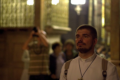
The Church of the Holy Sepulchre (Latin: Sanctum Sepulchrum), also called the Church of the Resurrection (Greek: Ναός της Αναστάσεως, Naos tis Anastaseos; Arabic: كنيسة القيامة, Kanīsat al-Qiyāma; Armenian: Սուրբ Հարություն, Surp Harutyun) by Eastern Christians, is a Christian church within the walled Old City of Jerusalem.
The site is venerated by most Christians as Golgotha,[1] (the Hill of Calvary), where the New Testament says that Jesus was crucified,[2] and is said to also contain the place where Jesus was buried (the sepulchre). The church has been an important pilgrimage destination since at least the 4th century, as the purported site of the death and resurrection of Jesus. Today it also serves as the headquarters of the Greek Orthodox Patriarch of Jerusalem, while control of the building is shared between several Christian churches and secular entities in complicated arrangements essentially unchanged for centuries.
en.wikipedia.org/wiki/Church_of_the_Holy_Sepulchre
Grotto Eyes

© Angela M. Lobefaro
Thanks to gadihext and to his very friendly family for the fantastic hospitality!
Rosh HaNikra ( [show location on an interactive map] 33°05′N 35°06′E / 33.083°N 35.1°E / 33.083; 35.1; Hebrew: ראש הנקרה, or Ras an-Naqoura, "head of the grottos") is a geologic formation in Israel, located on the coast of the Mediterranean Sea, in the Western Galilee near the border with Lebanon. It is a white chalk cliff face which opens up into spectacular grottos.
The Rosh HaNikra grottos are cavernous tunnels formed by sea action on the soft chalk rock. The total length is some 200 meters. They branch off in various directions with some interconnecting segments. In the past, the only access to them was from the sea and experienced divers were the only ones capable of visiting. Today a cable car takes visitors down to see the grottos. A kibbutz, also named Rosh HaNikra, is located nearby.
[edit] History
The Book of Joshua mentions "Misraphot Mayim" as a place south of Rosh HaNikra that was the border of the Israelite tribes of the time (13:6). Jewish sages referred to the cliff as "The Ladder of Tyre" (Hebrew: sullam Tzor).[citation needed] The site was later renamed A-Nawakir ("the grottos") after an Arab conquest. The present name, Rosh HaNikra, is a hebracized version of a latter dated Arabic variation "Ras-an-Nakura".
Throughout human history, Rosh HaNikra served as a passage point for trade caravans and armies between Lebanon, Syria, Israel, Egypt, and Africa. The British dug a tunnel through the nearby rocks for trains on what was the Cairo-Istanbul railway. A bridge was destroyed by Jewish underground fighters prior to 1948 during the operation Night of the bridges.
Rosh Hanikra was the site where Israeli and Lebanese officials negotiated and concluded an armistice in 1949 which ended the Lebanese-Israeli component of the 1948 War of Israeli Independence.
en.wikipedia.org/wiki/Rosh_HaNikra_grottoes
31 May, 2009
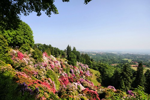
Sea of Rhododrendons
© Angela M. Lobefaro
my first Photo Guide: → HERE
taken in the Burcina Park, Biella, Piedmont, Italy (ca.10 kms from where we live )
Located 7 km from Biella is the Parco Burcina Nature Reserve. It occupies almost all of the hill very near the pre-Alpine foothills of the Biellese.
The park was a gift from the Piacenza family whose roots go back to the middle of the 19th-century. Giovanni Piacenza, a wool industrialist, decided to buy the hill and turn it into a park - one of the most admired in Italy.
Today the slopes of the hill are covered with beeches, pines, fir trees, cedars and various aromatic plants. Above all it is known for its rhododrendons (rhododendra) that comes from the Caucasus and the Himalayas.
They flower between mid May and the beginning of June and are well worth a visit. It also harbours many species of trees that come from all over the world.
www.piemonte-emozioni.it/natura/eng/parchi/burcina.shtml
www.parcoburcina.piemonte.it/index01.html
>>>This was my playground when I was a child, I lived very close to this Park!<<<
My Interestingness- Explore shots
My 50 Most Interesting shots
btw : link to my PUBLISHED shots
Subscribe to my stream
Read the interesting Interviews with some of my Flickr Friends !
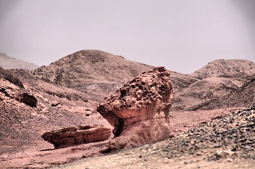
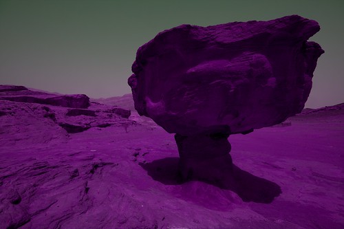
The Solomon's Pillars

© Angela M. Lobefaro
Timna Valley Park is a National Park in the Negev desert of Israel, located approximately 30km north of Eilat [1].
The Park is noted for its natural sandstone formations, including King Solomon's Pillars, the "Mushroom", "Arches" and "the Sleeping Lion".
It includes what are believed to be the oldest Copper mines in the world, dating back to at least 4000 BC and worked almost continuously by (among others) the Egyptians, Romans, Nabateans and Ummayads.
markers to Timna Park
Rock carvings, including "the Chariots", and ancient inscriptions are visible as well as mining shafts, the remains of ancient copper furnaces and a temple dedicated to the Egyptian goddess Hathor.[
Timna Valley Park
From Wikipedia, the free encyclopedia
Thanks to gadihext and to his very friendly family for the fantastic hospitality!
View on Dackr
Subscribe to my stream
30 May, 2009
Mute Witnesses
© Angela M. Lobefaro
Thanks to gadihext and to his very friendly family for the fantastic hospitality!
The Church of the Holy Sepulchre (Latin: Sanctum Sepulchrum), also called the Church of the Resurrection (Greek: Ναός της Αναστάσεως, Naos tis Anastaseos; Arabic: كنيسة القيامة, Kanīsat al-Qiyāma; Armenian: Սուրբ Հարություն, Surp Harutyun) by Eastern Christians, is a Christian church within the walled Old City of Jerusalem.
The site is venerated by most Christians as Golgotha,[1] (the Hill of Calvary), where the New Testament says that Jesus was crucified,[2] and is said to also contain the place where Jesus was buried (the sepulchre). The church has been an important pilgrimage destination since at least the 4th century, as the purported site of the death and resurrection of Jesus. Today it also serves as the headquarters of the Greek Orthodox Patriarch of Jerusalem, while control of the building is shared between several Christian churches and secular entities in complicated arrangements essentially unchanged for centuries.
en.wikipedia.org/wiki/Church_of_the_Holy_Sepulchre
Subscribe to my stream
View on Dackr
You've Come a Long Way, Baby
© Angela M. Lobefaro
Thanks to gadihext and to his very friendly family for the fantastic hospitality!
The Church of the Holy Sepulchre (Latin: Sanctum Sepulchrum), also called the Church of the Resurrection (Greek: Ναός της Αναστάσεως, Naos tis Anastaseos; Arabic: كنيسة القيامة, Kanīsat al-Qiyāma; Armenian: Սուրբ Հարություն, Surp Harutyun) by Eastern Christians, is a Christian church within the walled Old City of Jerusalem.
The site is venerated by most Christians as Golgotha,[1] (the Hill of Calvary), where the New Testament says that Jesus was crucified,[2] and is said to also contain the place where Jesus was buried (the sepulchre). The church has been an important pilgrimage destination since at least the 4th century, as the purported site of the death and resurrection of Jesus. Today it also serves as the headquarters of the Greek Orthodox Patriarch of Jerusalem, while control of the building is shared between several Christian churches and secular entities in complicated arrangements essentially unchanged for centuries.
en.wikipedia.org/wiki/Church_of_the_Holy_Sepulchre
Subscribe to my stream
View on Dackr
Man on The Moon
© Angela M. Lobefaro
Timna Valley Park is a National Park in the Negev desert of Israel, located approximately 30km north of Eilat [1].
The Park is noted for its natural sandstone formations, including King Solomon's Pillars, the "Mushroom", "Arches" and "the Sleeping Lion".
It includes what are believed to be the oldest Copper mines in the world, dating back to at least 4000 BC and worked almost continuously by (among others) the Egyptians, Romans, Nabateans and Ummayads.
markers to Timna Park
Rock carvings, including "the Chariots", and ancient inscriptions are visible as well as mining shafts, the remains of ancient copper furnaces and a temple dedicated to the Egyptian goddess Hathor.[
Timna Valley Park
From Wikipedia, the free encyclopedia
Thanks to gadihext and to his very friendly family for the fantastic hospitality!
Subscribe to my stream
29 May, 2009
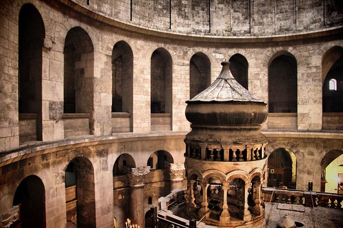
Church of the Holy Sepulchre v3

© Angela M. Lobefaro
Thanks to gadihext and to his very friendly family for the fantastic hospitality!
The Church of the Holy Sepulchre (Latin: Sanctum Sepulchrum), also called the Church of the Resurrection (Greek: Ναός της Αναστάσεως, Naos tis Anastaseos; Arabic: كنيسة القيامة, Kanīsat al-Qiyāma; Armenian: Սուրբ Հարություն, Surp Harutyun) by Eastern Christians, is a Christian church within the walled Old City of Jerusalem.
The site is venerated by most Christians as Golgotha,[1] (the Hill of Calvary), where the New Testament says that Jesus was crucified,[2] and is said to also contain the place where Jesus was buried (the sepulchre). The church has been an important pilgrimage destination since at least the 4th century, as the purported site of the death and resurrection of Jesus. Today it also serves as the headquarters of the Greek Orthodox Patriarch of Jerusalem, while control of the building is shared between several Christian churches and secular entities in complicated arrangements essentially unchanged for centuries.
en.wikipedia.org/wiki/Church_of_the_Holy_Sepulchre
View on Dackr
Happiness is a state of mind
© Angela M. Lobefaro
Thanks to gadihext and to his very friendly family for the fantastic hospitality!
28 May, 2009
Simple Gestures
© Angela M. Lobefaro
Thanks to gadihext and to his very friendly family for the fantastic hospitality!
The Church of the Holy Sepulchre (Latin: Sanctum Sepulchrum), also called the Church of the Resurrection (Greek: Ναός της Αναστάσεως, Naos tis Anastaseos; Arabic: كنيسة القيامة, Kanīsat al-Qiyāma; Armenian: Սուրբ Հարություն, Surp Harutyun) by Eastern Christians, is a Christian church within the walled Old City of Jerusalem.
The site is venerated by most Christians as Golgotha,[1] (the Hill of Calvary), where the New Testament says that Jesus was crucified,[2] and is said to also contain the place where Jesus was buried (the sepulchre). The church has been an important pilgrimage destination since at least the 4th century, as the purported site of the death and resurrection of Jesus. Today it also serves as the headquarters of the Greek Orthodox Patriarch of Jerusalem, while control of the building is shared between several Christian churches and secular entities in complicated arrangements essentially unchanged for centuries.
en.wikipedia.org/wiki/Church_of_the_Holy_Sepulchre
Subscribe to my stream
View on Dackr
26 May, 2009
Church of the Holy Sepulchre v2

© Angela M. Lobefaro
Thanks to gadihext and to his very friendly family for the fantastic hospitality!
The Church of the Holy Sepulchre (Latin: Sanctum Sepulchrum), also called the Church of the Resurrection (Greek: Ναός της Αναστάσεως, Naos tis Anastaseos; Arabic: كنيسة القيامة, Kanīsat al-Qiyāma; Armenian: Սուրբ Հարություն, Surp Harutyun) by Eastern Christians, is a Christian church within the walled Old City of Jerusalem.
The site is venerated by most Christians as Golgotha,[1] (the Hill of Calvary), where the New Testament says that Jesus was crucified,[2] and is said to also contain the place where Jesus was buried (the sepulchre). The church has been an important pilgrimage destination since at least the 4th century, as the purported site of the death and resurrection of Jesus. Today it also serves as the headquarters of the Greek Orthodox Patriarch of Jerusalem, while control of the building is shared between several Christian churches and secular entities in complicated arrangements essentially unchanged for centuries.
en.wikipedia.org/wiki/Church_of_the_Holy_Sepulchre
Jerusalem Western Wall

© Angela M. Lobefaro
Thanks to gadihext and to his very friendly family for the fantastic hospitality!
The Western Wall (Hebrew: הכותל המערבי, translit.: HaKotel HaMa'aravi) (Arabic: حائط البراق, translit.: Ḥā'iṭ Al-Burāq), sometimes referred to as the Wailing Wall or simply the Kotel (lit. Wall; Ashkenazic pronunciation: Kosel), and as al-Buraaq Wall by Muslims,[1] is an important Jewish religious site located in the Old City of Jerusalem. Just over half the wall, including its 17 courses located below street level, dates from the end of the Second Temple period, being constructed around 19 BCE by Herod the Great. The remaining layers were added from the 7th century onwards.
en.wikipedia.org/wiki/Western_Wall
25 May, 2009
Light My Faith
© Angela M. Lobefaro
Thanks to gadihext and to his very friendly family for the fantastic hospitality!
The Church of the Holy Sepulchre (Latin: Sanctum Sepulchrum), also called the Church of the Resurrection (Greek: Ναός της Αναστάσεως, Naos tis Anastaseos; Arabic: كنيسة القيامة, Kanīsat al-Qiyāma; Armenian: Սուրբ Հարություն, Surp Harutyun) by Eastern Christians, is a Christian church within the walled Old City of Jerusalem.
The site is venerated by most Christians as Golgotha,[1] (the Hill of Calvary), where the New Testament says that Jesus was crucified,[2] and is said to also contain the place where Jesus was buried (the sepulchre). The church has been an important pilgrimage destination since at least the 4th century, as the purported site of the death and resurrection of Jesus. Today it also serves as the headquarters of the Greek Orthodox Patriarch of Jerusalem, while control of the building is shared between several Christian churches and secular entities in complicated arrangements essentially unchanged for centuries.
en.wikipedia.org/wiki/Church_of_the_Holy_Sepulchre
The Sea of Galilee
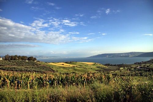
© Angela M. Lobefaro
The Sea of Gallilee, also Lake of Gennesaret, Lake Kinneret or Sea of Tiberias (Hebrew: ים כנרת), (Arabic: بحيرة طبريا), is Israel's largest freshwater lake, being approximately 53 km (33 miles) in circumference, about 21 km (13 miles) long, and 13 km (8 miles) wide. The lake has a total area of 166 km², and a maximum depth of approximately 43 m.[3] At 209 meters below sea level, it is the lowest freshwater lake on Earth and the second-lowest lake in the world (after the Dead Sea, a saltwater lake).[4]
The Kinneret is situated deep in the Jordan Great Rift Valley, the valley caused by the separation of the African and Arabian Plates and is fed partly by underground springs although its main source is the Jordan River which flows through it from north to south. Consequently the area is subject to earthquakes and, in the past, volcanic activity. This is evidenced by the abundant basalt and other igneous rocks that define the geology of the Galilee region.
en.wikipedia.org/wiki/Sea_of_Galilee
Thanks to gadihext and to his very friendly family for the fantastic hospitality!
24 May, 2009
The Dark Side of the Golan
© Angela M. Lobefaro
Thanks to gadihext and to his very friendly family for the fantastic hospitality!
Taken in the Golan Heights, in a place called "Custom House",
the place was an heavily fortified Syrian position. There are mine fields surrounding this place lasting from the '60.
Subscribe to my stream
22 May, 2009
Calatrava Remix
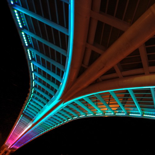
© Angela M. Lobefaro .
Thanks to gadihext and to his very friendly family for the fantastic hospitality!
We had an amazing holiday in the Holy Land with you, and we enjoyed to learn something about the Passover, the Feast of Unleavened Bread. Also called Chag HaMatzot,the Festival of Matzah, it commemorates the Exodus and freedom of the Israelites from ancient Egypt.
Passover, the Feast of Unleavened Bread. Also called Chag HaMatzot (the Festival of Matzah), it commemorates the Exodus and freedom of the Israelites from ancient Egypt.
Taken under Calatrava String Bridge in Petach Tiqwa, Israel
listen to:
There must be another way
Fishing @ Yaffo

© Angela M. Lobefaro
taken in Jaffa (Yaffo)
Thanks to gadihext and to his very friendly family for the fantastic hospitality!
21 May, 2009
Shyness is not a crime

© Angela M. Lobefaro
taken in Tel Aviv
( these two girls, were admiring a boy...)
Thanks to gadihext and to his very friendly family for the fantastic hospitality!
20 May, 2009
Not All Fungus are Equal
© Angela M. Lobefaro
Timna Valley Park is a National Park in the Negev desert of Israel, located approximately 30km north of Eilat [1].
The Park is noted for its natural sandstone formations, including King Solomon's Pillars, the "Mushroom", "Arches" and "the Sleeping Lion".
It includes what are believed to be the oldest Copper mines in the world, dating back to at least 4000 BC and worked almost continuously by (among others) the Egyptians, Romans, Nabateans and Ummayads.
markers to Timna Park
Rock carvings, including "the Chariots", and ancient inscriptions are visible as well as mining shafts, the remains of ancient copper furnaces and a temple dedicated to the Egyptian goddess Hathor.[
Timna Valley Park
From Wikipedia, the free encyclopedia
Thanks to gadihext and to his very friendly family for the fantastic hospitality!
Subscribe to my stream
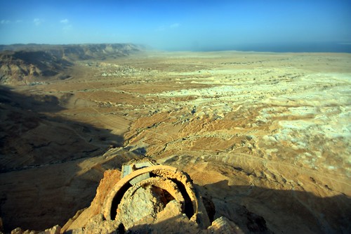
From Massada to the Dead Sea
© Angela M. Lobefaro
Taken in Massada, Israel
Thanks to gadihext and to his very friendly family for the fantastic hospitality!
Masada (Hebrew מצדה, pronounced Metzada, from מצודה, metzuda, "fortress") is the name for a site of ancient palaces and fortifications in the South District of Israel on top of an isolated rock plateau, or large mesa, on the eastern edge of the Judean Desert overlooking the Dead Sea. After the First Jewish-Roman War (also known as the Great Jewish Revolt) a siege of the fortress by troops of the Roman Empire led to the mass suicide of Jewish rebels, who preferred death to surrender.
en.wikipedia.org/wiki/Masada
19 May, 2009
Stone Age

© Angela M. Lobefaro
Timna Valley Park is a National Park in the Negev desert of Israel, located approximately 30km north of Eilat [1].
The Park is noted for its natural sandstone formations, including King Solomon's Pillars, the "Mushroom", "Arches" and "the Sleeping Lion".
It includes what are believed to be the oldest Copper mines in the world, dating back to at least 4000 BC and worked almost continuously by (among others) the Egyptians, Romans, Nabateans and Ummayads.
markers to Timna Park
Rock carvings, including "the Chariots", and ancient inscriptions are visible as well as mining shafts, the remains of ancient copper furnaces and a temple dedicated to the Egyptian goddess Hathor.[
Timna Valley Park
From Wikipedia, the free encyclopedia
Thanks to gadihext and to his very friendly family for the fantastic hospitality!
In Italia la cultura non è più una roba seria
Subscribe to my stream
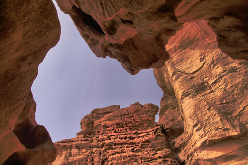
Misterious Cave
© Angela M. Lobefaro Explore
Timna Valley Park is a National Park in the Negev desert of Israel, located approximately 30km north of Eilat [1].
The Park is noted for its natural sandstone formations, including King Solomon's Pillars, the "Mushroom", "Arches" and "the Sleeping Lion".
It includes what are believed to be the oldest Copper mines in the world, dating back to at least 4000 BC and worked almost continuously by (among others) the Egyptians, Romans, Nabateans and Ummayads.
markers to Timna Park
Rock carvings, including "the Chariots", and ancient inscriptions are visible as well as mining shafts, the remains of ancient copper furnaces and a temple dedicated to the Egyptian goddess Hathor.[
Timna Valley Park
From Wikipedia, the free encyclopedia
Thanks to gadihext and to his very friendly family for the fantastic hospitality!
Subscribe to my stream
Subscribe to:
Posts (Atom)


