© Angela M. Lobefaro
my first Photo Guide: → HERE
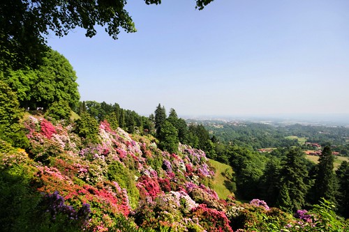
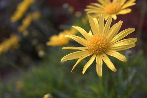
taken in the Burcina Park, Biella, Piedmont, Italy (ca.10 kms from where we live )
Located 7 km from Biella is the Parco Burcina Nature Reserve. It occupies almost all of the hill very near the pre-Alpine foothills of the Biellese.
The park was a gift from the Piacenza family whose roots go back to the middle of the 19th-century. Giovanni Piacenza, a wool industrialist, decided to buy the hill and turn it into a park - one of the most admired in Italy.
Today the slopes of the hill are covered with beeches, pines, fir trees, cedars and various aromatic plants. Above all it is known for its rhododrendons (rhododendra) that comes from the Caucasus and the Himalayas.
They flower between mid May and the beginning of June and are well worth a visit. It also harbours many species of trees that come from all over the world.
www.piemonte-emozioni.it/natura/eng/parchi/burcina.shtml
www.parcoburcina.piemonte.it/index01.html
>>>This was my playground when I was a child, I lived very close to this Park!<<<
My Interestingness- Explore shots
My 50 Most Interesting shots
btw : link to my PUBLISHED shots
Subscribe to my stream
Read the interesting Interviews with some of my Flickr Friends !
31 May, 2009
Sea of Rhododrendons
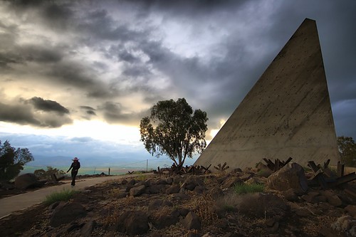
The Solomon's Pillars

© Angela M. Lobefaro
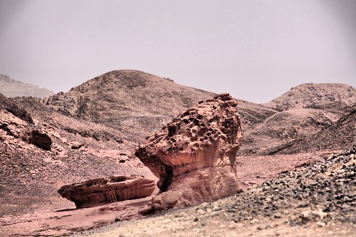
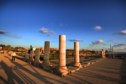
Timna Valley Park is a National Park in the Negev desert of Israel, located approximately 30km north of Eilat [1].
The Park is noted for its natural sandstone formations, including King Solomon's Pillars, the "Mushroom", "Arches" and "the Sleeping Lion".
It includes what are believed to be the oldest Copper mines in the world, dating back to at least 4000 BC and worked almost continuously by (among others) the Egyptians, Romans, Nabateans and Ummayads.
markers to Timna Park
Rock carvings, including "the Chariots", and ancient inscriptions are visible as well as mining shafts, the remains of ancient copper furnaces and a temple dedicated to the Egyptian goddess Hathor.[
Timna Valley Park
From Wikipedia, the free encyclopedia
Thanks to gadihext and to his very friendly family for the fantastic hospitality!
View on Dackr
Subscribe to my stream
30 May, 2009
Mute Witnesses
© Angela M. Lobefaro
Thanks to gadihext and to his very friendly family for the fantastic hospitality!
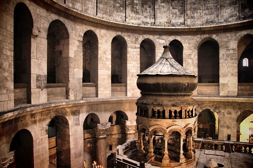
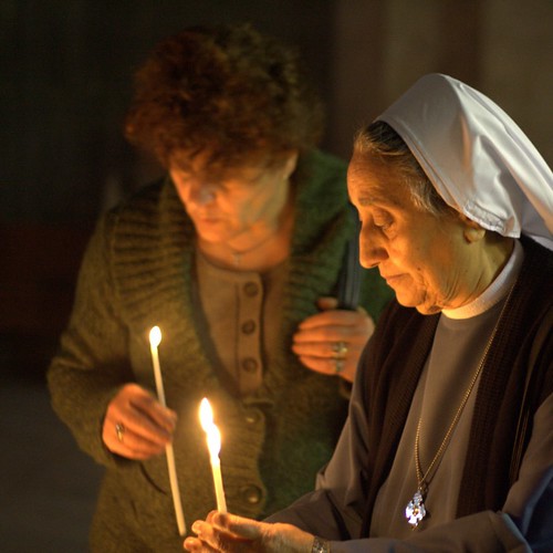
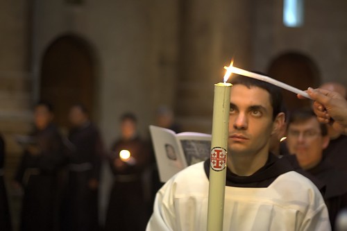
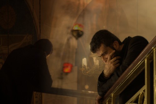
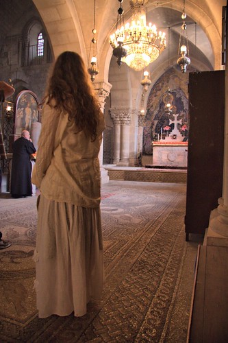
The Church of the Holy Sepulchre (Latin: Sanctum Sepulchrum), also called the Church of the Resurrection (Greek: Ναός της Αναστάσεως, Naos tis Anastaseos; Arabic: كنيسة القيامة, Kanīsat al-Qiyāma; Armenian: Սուրբ Հարություն, Surp Harutyun) by Eastern Christians, is a Christian church within the walled Old City of Jerusalem.
The site is venerated by most Christians as Golgotha,[1] (the Hill of Calvary), where the New Testament says that Jesus was crucified,[2] and is said to also contain the place where Jesus was buried (the sepulchre). The church has been an important pilgrimage destination since at least the 4th century, as the purported site of the death and resurrection of Jesus. Today it also serves as the headquarters of the Greek Orthodox Patriarch of Jerusalem, while control of the building is shared between several Christian churches and secular entities in complicated arrangements essentially unchanged for centuries.
en.wikipedia.org/wiki/Church_of_the_Holy_Sepulchre
Subscribe to my stream
View on Dackr
You've Come a Long Way, Baby
© Angela M. Lobefaro
Thanks to gadihext and to his very friendly family for the fantastic hospitality!
The Church of the Holy Sepulchre (Latin: Sanctum Sepulchrum), also called the Church of the Resurrection (Greek: Ναός της Αναστάσεως, Naos tis Anastaseos; Arabic: كنيسة القيامة, Kanīsat al-Qiyāma; Armenian: Սուրբ Հարություն, Surp Harutyun) by Eastern Christians, is a Christian church within the walled Old City of Jerusalem.
The site is venerated by most Christians as Golgotha,[1] (the Hill of Calvary), where the New Testament says that Jesus was crucified,[2] and is said to also contain the place where Jesus was buried (the sepulchre). The church has been an important pilgrimage destination since at least the 4th century, as the purported site of the death and resurrection of Jesus. Today it also serves as the headquarters of the Greek Orthodox Patriarch of Jerusalem, while control of the building is shared between several Christian churches and secular entities in complicated arrangements essentially unchanged for centuries.
en.wikipedia.org/wiki/Church_of_the_Holy_Sepulchre
Subscribe to my stream
View on Dackr
Man on The Moon
© Angela M. Lobefaro
Timna Valley Park is a National Park in the Negev desert of Israel, located approximately 30km north of Eilat [1].
The Park is noted for its natural sandstone formations, including King Solomon's Pillars, the "Mushroom", "Arches" and "the Sleeping Lion".
It includes what are believed to be the oldest Copper mines in the world, dating back to at least 4000 BC and worked almost continuously by (among others) the Egyptians, Romans, Nabateans and Ummayads.
markers to Timna Park
Rock carvings, including "the Chariots", and ancient inscriptions are visible as well as mining shafts, the remains of ancient copper furnaces and a temple dedicated to the Egyptian goddess Hathor.[
Timna Valley Park
From Wikipedia, the free encyclopedia
Thanks to gadihext and to his very friendly family for the fantastic hospitality!
Subscribe to my stream
29 May, 2009
Church of the Holy Sepulchre v3

© Angela M. Lobefaro
Thanks to gadihext and to his very friendly family for the fantastic hospitality!
The Church of the Holy Sepulchre (Latin: Sanctum Sepulchrum), also called the Church of the Resurrection (Greek: Ναός της Αναστάσεως, Naos tis Anastaseos; Arabic: كنيسة القيامة, Kanīsat al-Qiyāma; Armenian: Սուրբ Հարություն, Surp Harutyun) by Eastern Christians, is a Christian church within the walled Old City of Jerusalem.
The site is venerated by most Christians as Golgotha,[1] (the Hill of Calvary), where the New Testament says that Jesus was crucified,[2] and is said to also contain the place where Jesus was buried (the sepulchre). The church has been an important pilgrimage destination since at least the 4th century, as the purported site of the death and resurrection of Jesus. Today it also serves as the headquarters of the Greek Orthodox Patriarch of Jerusalem, while control of the building is shared between several Christian churches and secular entities in complicated arrangements essentially unchanged for centuries.
en.wikipedia.org/wiki/Church_of_the_Holy_Sepulchre
View on Dackr
Happiness is a state of mind
© Angela M. Lobefaro
Thanks to gadihext and to his very friendly family for the fantastic hospitality!
28 May, 2009
Simple Gestures
© Angela M. Lobefaro
Thanks to gadihext and to his very friendly family for the fantastic hospitality!
The Church of the Holy Sepulchre (Latin: Sanctum Sepulchrum), also called the Church of the Resurrection (Greek: Ναός της Αναστάσεως, Naos tis Anastaseos; Arabic: كنيسة القيامة, Kanīsat al-Qiyāma; Armenian: Սուրբ Հարություն, Surp Harutyun) by Eastern Christians, is a Christian church within the walled Old City of Jerusalem.
The site is venerated by most Christians as Golgotha,[1] (the Hill of Calvary), where the New Testament says that Jesus was crucified,[2] and is said to also contain the place where Jesus was buried (the sepulchre). The church has been an important pilgrimage destination since at least the 4th century, as the purported site of the death and resurrection of Jesus. Today it also serves as the headquarters of the Greek Orthodox Patriarch of Jerusalem, while control of the building is shared between several Christian churches and secular entities in complicated arrangements essentially unchanged for centuries.
en.wikipedia.org/wiki/Church_of_the_Holy_Sepulchre
Subscribe to my stream
View on Dackr
26 May, 2009
Church of the Holy Sepulchre v2

© Angela M. Lobefaro
Thanks to gadihext and to his very friendly family for the fantastic hospitality!
The Church of the Holy Sepulchre (Latin: Sanctum Sepulchrum), also called the Church of the Resurrection (Greek: Ναός της Αναστάσεως, Naos tis Anastaseos; Arabic: كنيسة القيامة, Kanīsat al-Qiyāma; Armenian: Սուրբ Հարություն, Surp Harutyun) by Eastern Christians, is a Christian church within the walled Old City of Jerusalem.
The site is venerated by most Christians as Golgotha,[1] (the Hill of Calvary), where the New Testament says that Jesus was crucified,[2] and is said to also contain the place where Jesus was buried (the sepulchre). The church has been an important pilgrimage destination since at least the 4th century, as the purported site of the death and resurrection of Jesus. Today it also serves as the headquarters of the Greek Orthodox Patriarch of Jerusalem, while control of the building is shared between several Christian churches and secular entities in complicated arrangements essentially unchanged for centuries.
en.wikipedia.org/wiki/Church_of_the_Holy_Sepulchre
Jerusalem Western Wall

© Angela M. Lobefaro
Thanks to gadihext and to his very friendly family for the fantastic hospitality!
The Western Wall (Hebrew: הכותל המערבי, translit.: HaKotel HaMa'aravi) (Arabic: حائط البراق, translit.: Ḥā'iṭ Al-Burāq), sometimes referred to as the Wailing Wall or simply the Kotel (lit. Wall; Ashkenazic pronunciation: Kosel), and as al-Buraaq Wall by Muslims,[1] is an important Jewish religious site located in the Old City of Jerusalem. Just over half the wall, including its 17 courses located below street level, dates from the end of the Second Temple period, being constructed around 19 BCE by Herod the Great. The remaining layers were added from the 7th century onwards.
en.wikipedia.org/wiki/Western_Wall
25 May, 2009
Light My Faith
© Angela M. Lobefaro
Thanks to gadihext and to his very friendly family for the fantastic hospitality!
The Church of the Holy Sepulchre (Latin: Sanctum Sepulchrum), also called the Church of the Resurrection (Greek: Ναός της Αναστάσεως, Naos tis Anastaseos; Arabic: كنيسة القيامة, Kanīsat al-Qiyāma; Armenian: Սուրբ Հարություն, Surp Harutyun) by Eastern Christians, is a Christian church within the walled Old City of Jerusalem.
The site is venerated by most Christians as Golgotha,[1] (the Hill of Calvary), where the New Testament says that Jesus was crucified,[2] and is said to also contain the place where Jesus was buried (the sepulchre). The church has been an important pilgrimage destination since at least the 4th century, as the purported site of the death and resurrection of Jesus. Today it also serves as the headquarters of the Greek Orthodox Patriarch of Jerusalem, while control of the building is shared between several Christian churches and secular entities in complicated arrangements essentially unchanged for centuries.
en.wikipedia.org/wiki/Church_of_the_Holy_Sepulchre
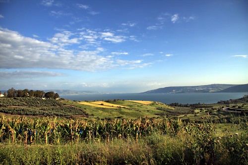
The Sea of Galilee
© Angela M. Lobefaro
The Sea of Gallilee, also Lake of Gennesaret, Lake Kinneret or Sea of Tiberias (Hebrew: ים כנרת), (Arabic: بحيرة طبريا), is Israel's largest freshwater lake, being approximately 53 km (33 miles) in circumference, about 21 km (13 miles) long, and 13 km (8 miles) wide. The lake has a total area of 166 km², and a maximum depth of approximately 43 m.[3] At 209 meters below sea level, it is the lowest freshwater lake on Earth and the second-lowest lake in the world (after the Dead Sea, a saltwater lake).[4]
The Kinneret is situated deep in the Jordan Great Rift Valley, the valley caused by the separation of the African and Arabian Plates and is fed partly by underground springs although its main source is the Jordan River which flows through it from north to south. Consequently the area is subject to earthquakes and, in the past, volcanic activity. This is evidenced by the abundant basalt and other igneous rocks that define the geology of the Galilee region.
en.wikipedia.org/wiki/Sea_of_Galilee
Thanks to gadihext and to his very friendly family for the fantastic hospitality!
24 May, 2009
The Dark Side of the Golan
© Angela M. Lobefaro
Thanks to gadihext and to his very friendly family for the fantastic hospitality!
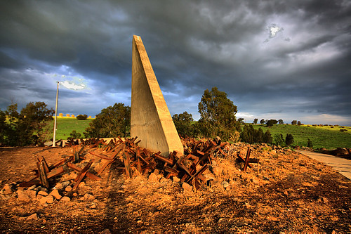
Taken in the Golan Heights, in a place called "Custom House",
the place was an heavily fortified Syrian position. There are mine fields surrounding this place lasting from the '60.
Subscribe to my stream
22 May, 2009
Calatrava Remix
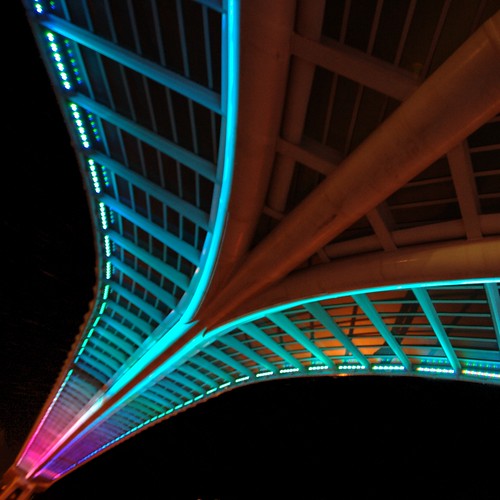
© Angela M. Lobefaro .
Thanks to gadihext and to his very friendly family for the fantastic hospitality!
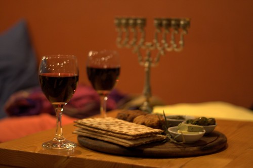
We had an amazing holiday in the Holy Land with you, and we enjoyed to learn something about the Passover, the Feast of Unleavened Bread. Also called Chag HaMatzot,the Festival of Matzah, it commemorates the Exodus and freedom of the Israelites from ancient Egypt.
Passover, the Feast of Unleavened Bread. Also called Chag HaMatzot (the Festival of Matzah), it commemorates the Exodus and freedom of the Israelites from ancient Egypt.
Taken under Calatrava String Bridge in Petach Tiqwa, Israel
listen to:
There must be another way
Fishing @ Yaffo

© Angela M. Lobefaro
taken in Jaffa (Yaffo)
Thanks to gadihext and to his very friendly family for the fantastic hospitality!
21 May, 2009
Shyness is not a crime

© Angela M. Lobefaro
taken in Tel Aviv
( these two girls, were admiring a boy...)
Thanks to gadihext and to his very friendly family for the fantastic hospitality!
20 May, 2009
Not All Fungus are Equal
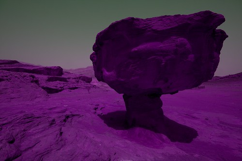
© Angela M. Lobefaro
Timna Valley Park is a National Park in the Negev desert of Israel, located approximately 30km north of Eilat [1].
The Park is noted for its natural sandstone formations, including King Solomon's Pillars, the "Mushroom", "Arches" and "the Sleeping Lion".
It includes what are believed to be the oldest Copper mines in the world, dating back to at least 4000 BC and worked almost continuously by (among others) the Egyptians, Romans, Nabateans and Ummayads.
markers to Timna Park
Rock carvings, including "the Chariots", and ancient inscriptions are visible as well as mining shafts, the remains of ancient copper furnaces and a temple dedicated to the Egyptian goddess Hathor.[
Timna Valley Park
From Wikipedia, the free encyclopedia
Thanks to gadihext and to his very friendly family for the fantastic hospitality!
Subscribe to my stream
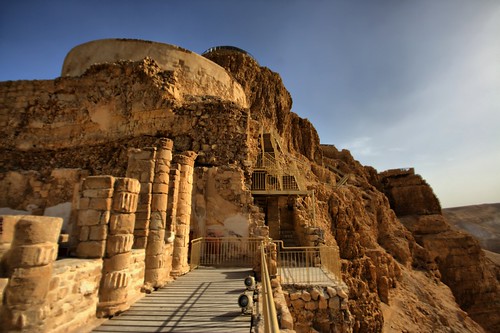
From Massada to the Dead Sea
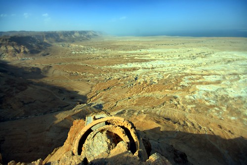
© Angela M. Lobefaro
Taken in Massada, Israel
Thanks to gadihext and to his very friendly family for the fantastic hospitality!
Masada (Hebrew מצדה, pronounced Metzada, from מצודה, metzuda, "fortress") is the name for a site of ancient palaces and fortifications in the South District of Israel on top of an isolated rock plateau, or large mesa, on the eastern edge of the Judean Desert overlooking the Dead Sea. After the First Jewish-Roman War (also known as the Great Jewish Revolt) a siege of the fortress by troops of the Roman Empire led to the mass suicide of Jewish rebels, who preferred death to surrender.
en.wikipedia.org/wiki/Masada
19 May, 2009
Stone Age

© Angela M. Lobefaro
Timna Valley Park is a National Park in the Negev desert of Israel, located approximately 30km north of Eilat [1].
The Park is noted for its natural sandstone formations, including King Solomon's Pillars, the "Mushroom", "Arches" and "the Sleeping Lion".
It includes what are believed to be the oldest Copper mines in the world, dating back to at least 4000 BC and worked almost continuously by (among others) the Egyptians, Romans, Nabateans and Ummayads.
markers to Timna Park
Rock carvings, including "the Chariots", and ancient inscriptions are visible as well as mining shafts, the remains of ancient copper furnaces and a temple dedicated to the Egyptian goddess Hathor.[
Timna Valley Park
From Wikipedia, the free encyclopedia
Thanks to gadihext and to his very friendly family for the fantastic hospitality!
In Italia la cultura non è più una roba seria
Subscribe to my stream
Misterious Cave
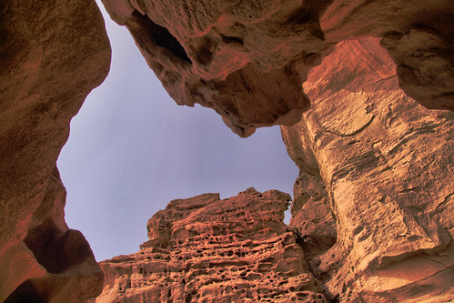
© Angela M. Lobefaro Explore
Timna Valley Park is a National Park in the Negev desert of Israel, located approximately 30km north of Eilat [1].
The Park is noted for its natural sandstone formations, including King Solomon's Pillars, the "Mushroom", "Arches" and "the Sleeping Lion".
It includes what are believed to be the oldest Copper mines in the world, dating back to at least 4000 BC and worked almost continuously by (among others) the Egyptians, Romans, Nabateans and Ummayads.
markers to Timna Park
Rock carvings, including "the Chariots", and ancient inscriptions are visible as well as mining shafts, the remains of ancient copper furnaces and a temple dedicated to the Egyptian goddess Hathor.[
Timna Valley Park
From Wikipedia, the free encyclopedia
Thanks to gadihext and to his very friendly family for the fantastic hospitality!
Subscribe to my stream
18 May, 2009
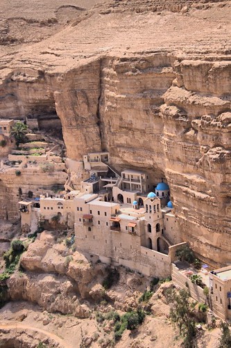
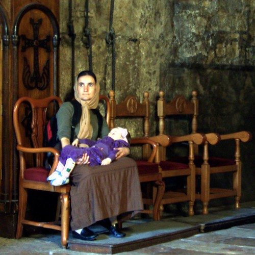
The Hidden Rebel's Base
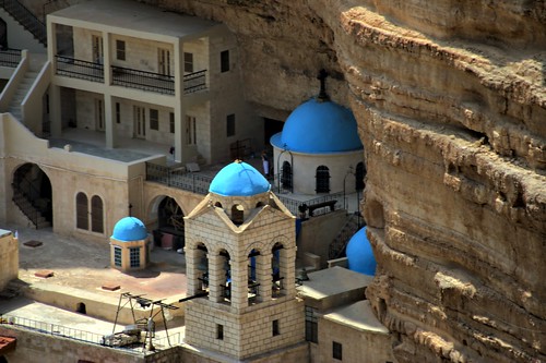
© Angela M. Lobefaro
Thanks to gadihext and to his very friendly family for the fantastic hospitality!
The Monastery of St. George clings to the canyon walls like a fairy-tale castle . Of all the monasteries founded in this spectacularly austere area between the 4th and 7th centuries AD, it is the only survivor. The first monks to settle as hermits in the caves in this part of the wadi were named Prono, Elias, Gannaios, Ainan and Zenon (about 420 AD). The monastery itself, dedicated to the Virgin Mary, was founded by St. John of Thebes (about 480 AD) as a spiritual center for the hermits of the region. Supposedly it was built over a cave where Joachin took refuge to lament the infertility of his wife, Anna. An angel told him to return to Anna, who afterward gave birth to the Virgin Mary. In the 6th century AD the monastery became known as St. George under the leadership of George of Koziba.
Born in Cyprus about 550 AD, George lived for a time in Jordan, but later an intense longing for a more ascetic life brought him to the Wadi Kelt. During the Persian invasion of Palestine in 614 AD, the monastery was destroyed and many of its monks were killed. A Greek-Arabic inscription above the old entrance testifies to its reconstruction by Crusaders in 1179. But most of the present monastery dates back to a 1879-1901 reconstruction by the Greek Orthodox Church. The oldest part of the building is the 6th century AD mosaic floor of the neighboring Church of St. John. The skulls of the monks martyred by the Persians are kept here and a niche contains the tomb of St. George.
www.welcometohosanna.com/LIFE_OF_JESUS/wadikelt2.htm
17 May, 2009
Return from the Mall
© Angela M. Lobefaro
The Monastery of St. George clings to the canyon walls like a fairy-tale castle . Of all the monasteries founded in this spectacularly austere area between the 4th and 7th centuries AD, it is the only survivor. The first monks to settle as hermits in the caves in this part of the wadi were named Prono, Elias, Gannaios, Ainan and Zenon (about 420 AD). The monastery itself, dedicated to the Virgin Mary, was founded by St. John of Thebes (about 480 AD) as a spiritual center for the hermits of the region. Supposedly it was built over a cave where Joachin took refuge to lament the infertility of his wife, Anna. An angel told him to return to Anna, who afterward gave birth to the Virgin Mary. In the 6th century AD the monastery became known as St. George under the leadership of George of Koziba.
Born in Cyprus about 550 AD, George lived for a time in Jordan, but later an intense longing for a more ascetic life brought him to the Wadi Kelt. During the Persian invasion of Palestine in 614 AD, the monastery was destroyed and many of its monks were killed. A Greek-Arabic inscription above the old entrance testifies to its reconstruction by Crusaders in 1179. But most of the present monastery dates back to a 1879-1901 reconstruction by the Greek Orthodox Church. The oldest part of the building is the 6th century AD mosaic floor of the neighboring Church of St. John. The skulls of the monks martyred by the Persians are kept here and a niche contains the tomb of St. George.
www.welcometohosanna.com/LIFE_OF_JESUS/wadikelt2.htm
Subscribe to my stream
16 May, 2009
Torment in Solitude
© Angela M. Lobefaro
Thanks to gadihext and to his very friendly family for the fantastic hospitality!
The Church of the Holy Sepulchre (Latin: Sanctum Sepulchrum), also called the Church of the Resurrection (Greek: Ναός της Αναστάσεως, Naos tis Anastaseos; Arabic: كنيسة القيامة, Kanīsat al-Qiyāma; Armenian: Սուրբ Հարություն, Surp Harutyun) by Eastern Christians, is a Christian church within the walled Old City of Jerusalem.
The site is venerated by most Christians as Golgotha,[1] (the Hill of Calvary), where the New Testament says that Jesus was crucified,[2] and is said to also contain the place where Jesus was buried (the sepulchre). The church has been an important pilgrimage destination since at least the 4th century, as the purported site of the death and resurrection of Jesus. Today it also serves as the headquarters of the Greek Orthodox Patriarch of Jerusalem, while control of the building is shared between several Christian churches and secular entities in complicated arrangements essentially unchanged for centuries.
en.wikipedia.org/wiki/Church_of_the_Holy_Sepulchre
Viewpoints (Church of the Holy Sepulchre)
© Angela M. Lobefaro
Thanks to gadihext and to his very friendly family for the fantastic hospitality!
The Church of the Holy Sepulchre (Latin: Sanctum Sepulchrum), also called the Church of the Resurrection (Greek: Ναός της Αναστάσεως, Naos tis Anastaseos; Arabic: كنيسة القيامة, Kanīsat al-Qiyāma; Armenian: Սուրբ Հարություն, Surp Harutyun) by Eastern Christians, is a Christian church within the walled Old City of Jerusalem.
The site is venerated by most Christians as Golgotha,[1] (the Hill of Calvary), where the New Testament says that Jesus was crucified,[2] and is said to also contain the place where Jesus was buried (the sepulchre). The church has been an important pilgrimage destination since at least the 4th century, as the purported site of the death and resurrection of Jesus. Today it also serves as the headquarters of the Greek Orthodox Patriarch of Jerusalem, while control of the building is shared between several Christian churches and secular entities in complicated arrangements essentially unchanged for centuries.
en.wikipedia.org/wiki/Church_of_the_Holy_Sepulchre
15 May, 2009
Tribute to Caesar
© Angela M. Lobefaro
Thanks to gadihext and to his very friendly family for the fantastic hospitality!
Caesarea was originally called Straton's Tower after its founder Straton, who is believed to have been a ruler of Sidon in the 4th century BCE. In 96 BCE the city was captured by Alexander Yannai and remained in the Hasmonean kingdom until it became an autonomous city by Pompey. After being for some time in the possession of Cleopatra, ruler of Egypt, it was returned by Augustus to Herod.
Once the site of a Phoenician port, over the course of 12 years Herod built Caesarea into the grandest city other than Jerusalem in Palestine, with a deep sea harbor (called Sebastos, i.e., Augustus in Greek), aqueduct, hippodrome and magnificent amphitheater that remain standing today. Herod renamed the city Caesarea in honor of the emperor. The population of Caesarea was half gentile and half Jewish, often causing disputes among the people. In 6 CE, Caesarea became the home of the Roman governors (Procurators) of Judea. The city remained the capital of Roman and Byzantine Palestine.
www.jewishvirtuallibrary.org/jsource/vie/Caesarea.html
14 May, 2009
Simple Pleasures
© Angela M. Lobefaro
Taken in a very cool restaurant in Galilee, Israel: the chairs are pillows!
Thanks to gadihext and to his very friendly family for the fantastic hospitality!
13 May, 2009
Mount Arbel

© Angela M. Lobefaro
Thanks to gadihext and to his very friendly family for the fantastic hospitality!
Mount Arbel (Hebrew: הר ארבל, Transliteration: Har Arbel) is a mountain in The Lower Galilee near Tiberias in Israel, that has split into two after an earthquake. The other half of is Mt. Nitai. On the mountain there are four settlements: Kfar Zeitim, Arbel, Kfar Hittim, and Mitspeh. The peak, at 282 meters above sea level (481 meters above the surrounding area), dominates the entire surroundings (much of the area is below sea level) and from the lookout atop the mountain, one can see almost all of the Galilee into the Golan Heights including Safed, Tiberias and most of the Sea of Galilee.
Near the mountain remain the ruins of an ancient Jewish settlement including a Synagogue from the fourth century C.E. with extend pews and columns, and dug into the mountain itself are a number of cliff dwellings. The extant cliff dwellings are from the 17th century and were built by the Druze though there are documented Jewish cliff dwellings dating back to the Second Commonwealth in the area. Josephus writes about the Roman conquest of some of the last Hasmonean rebels who dwelt in the cliffs of Mt Arbel.
On the south side, there is a gradual prolonged climb through agricultural and pasture land while on the other, there is a very steep 400 meters drop. At the top of the steeper Northern side, there are metal handholds driven into the rock because the climb is so steep. Below that are a series of switchbacks that eventually lead to the Bedouin village of Hamaam.
In 2008, it was announced that a new golf course resort, designed by Robert Trent Jones, Jr. would be constructed at a cost of $150 million, on land owned by Kfar Hittim on Mount Arbel. The resort which should open in 2011, will cater for between 600-900 people as well as creating 300-400 jobs.[1]
Mt. Arbel, with its 110 meters vertical drop, is the only known mountain in Israel to serve as a base jumping site.[citation needed] The hike to the top of Mount Arbel is included in the Israel National Trail.
en.wikipedia.org/wiki/Mount_Arbel
11 May, 2009
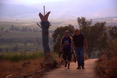
The "Custom House" - Golan Heights
© Angela M. Lobefaro
Thanks to gadihext and to his very friendly family for the fantastic hospitality!
Taken in the Golan Heights, in a place called "Custom House",
the place was an heavily fortified Syrian position. There are mine fields surrounding this place lasting from the '60.
Subscribe to my stream
10 May, 2009
Sunset Hunters
© Angela M. Lobefaro
Thanks to gadihext and to his very friendly family for the fantastic hospitality!
Taken in the Golan Heights, in a place called "Custom House"
Subscribe to my stream
Suburban Blue Hour (SBH for friends )
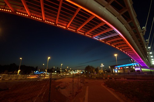
© Angela M. Lobefaro
Thanks to gadihext and to his very friendly family for the fantastic hospitality!
Taken under Calatrava String Bridge in Petach Tiqwa, Israel
listen to:
There must be another way
09 May, 2009
Fill the Gap
© Angela M. Lobefaro
Taken in Tel Aviv , Israel
Thanks to gadihext and to his very friendly family for the fantastic hospitality!
a view on Tel Aviv
Waiting for Gadi
© Angela M. Lobefaro
Taken in Tel Aviv Harbor, Israel
Thanks to gadihext and to his very friendly family for the fantastic hospitality!
Waiting for Gadi
© Angela M. Lobefaro
Taken in Tel Aviv Harbor, Israel
Thanks to gadihext and to his very friendly family for the fantastic hospitality!
Over and Over

© Angela M. Lobefaro
Taken in Tel Aviv Harbor, Israel
Thanks to gadihext and to his very friendly family for the fantastic hospitality!
Kids playing over and over with skates
08 May, 2009
Massada North Side
© Angela M. Lobefaro
Taken in Massada, Israel
Thanks to gadihext and to his very friendly family for the fantastic hospitality!
Masada (Hebrew מצדה, pronounced Metzada, from מצודה, metzuda, "fortress") is the name for a site of ancient palaces and fortifications in the South District of Israel on top of an isolated rock plateau, or large mesa, on the eastern edge of the Judean Desert overlooking the Dead Sea. After the First Jewish-Roman War (also known as the Great Jewish Revolt) a siege of the fortress by troops of the Roman Empire led to the mass suicide of Jewish rebels, who preferred death to surrender.
en.wikipedia.org/wiki/Masada
07 May, 2009
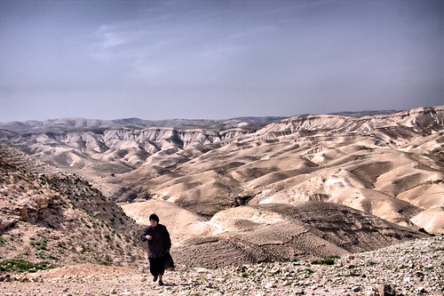
Route 90
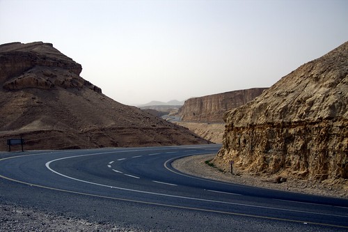
© Angela M. Lobefaro
Thanks to gadihext and to his very friendly family for the fantastic hospitality!
Route 90 is the longest road in Israel, at about 480 km, and stretches from Metula and the northern border with Lebanon, along the western side of the Sea of Galilee, through the Jordan River Valley, along the western bank of the Dead Sea (making it the world's lowest road), through the Arabah valley, and until Eilat and the southern border with Egypt on the Red Sea. The road passes through the West Bank near the city of Jericho but does not enter Palestinian Authority controlled areas.
The section of route 90 passing through the Jordan Valley was dedicated as Derekh Gandi (Gandhi's Road) after the late Rehavam Zeevi, an assassinated Israeli Minister of Tourism, who was nicknamed after Mahatma Gandhi.
06 May, 2009
Desert Temptation
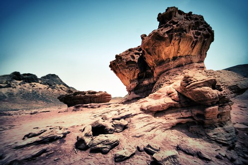
© Angela M. Lobefaro
Thanks to gadihext and to his very friendly family for the fantastic hospitality!
The Timna Valley is located in southern Israel in the southwestern Arabah, approximately 30 km (18.6 mi) north of the Gulf of Aqaba and the town of Eilat. The area is rich in copper ore, and has been actively mined by humans since the 6th millennium BCE.
Timna Valley Park is a National Park in the Negev desert of Israel, located approximately 30km north of Eilat [1].
The Park is noted for its natural sandstone formations, including King Solomon's Pillars, the "Mushroom", "Arches" and "the Sleeping Lion".
It includes what are believed to be the oldest Copper mines in the world, dating back to at least 4000 BC and worked almost continuously by (among others) the Egyptians, Romans, Nabateans and Ummayads.
markers to Timna Park
Rock carvings, including "the Chariots", and ancient inscriptions are visible as well as mining shafts, the remains of ancient copper furnaces and a temple dedicated to the Egyptian goddess Hathor.[2]
en.wikipedia.org/wiki/Timna_valley
en.wikipedia.org/wiki/Timna_Valley_Park
05 May, 2009
Me in Eilat
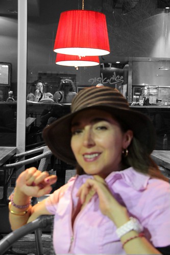
© Angela M. Lobefaro
Thanks to gadihext and to his very friendly family for the fantastic hospitality!
Eilat is Israel's southernmost city, a busy port as well as a popular resort, located at the northern tip of the Red Sea, on the Gulf of Eilat. Home to 46,900 people,[1] the city is part of the Southern Negev Desert, at the southern end of the Arava. The city is adjacent to the Egyptian village of Taba, to the south, and the Jordanian port city of Aqaba, to the east.
Eilat's arid desert climate is moderated by proximity to a warm sea. Temperatures often exceed 40 °C (104 °F) in summer, and 18 °C (64 °F) in winter, while water temperatures range between 20 and 26 °C (68-79 °F). The city's beaches, nightlife and desert landscapes make it a popular destination for domestic and international tourism.
en.wikipedia.org/wiki/Eilat
The Big Sand Snake

© Angela M. Lobefaro
Listening to:
The Beatles - The Long and Winding Road
Thanks to gadihext and to his very friendly family for the fantastic hospitality!
The Monastery of St. George clings to the canyon walls like a fairy-tale castle . Of all the monasteries founded in this spectacularly austere area between the 4th and 7th centuries AD, it is the only survivor. The first monks to settle as hermits in the caves in this part of the wadi were named Prono, Elias, Gannaios, Ainan and Zenon (about 420 AD). The monastery itself, dedicated to the Virgin Mary, was founded by St. John of Thebes (about 480 AD) as a spiritual center for the hermits of the region. Supposedly it was built over a cave where Joachin took refuge to lament the infertility of his wife, Anna. An angel told him to return to Anna, who afterward gave birth to the Virgin Mary. In the 6th century AD the monastery became known as St. George under the leadership of George of Koziba.
Born in Cyprus about 550 AD, George lived for a time in Jordan, but later an intense longing for a more ascetic life brought him to the Wadi Kelt. During the Persian invasion of Palestine in 614 AD, the monastery was destroyed and many of its monks were killed. A Greek-Arabic inscription above the old entrance testifies to its reconstruction by Crusaders in 1179. But most of the present monastery dates back to a 1879-1901 reconstruction by the Greek Orthodox Church. The oldest part of the building is the 6th century AD mosaic floor of the neighboring Church of St. John. The skulls of the monks martyred by the Persians are kept here and a niche contains the tomb of St. George.
www.welcometohosanna.com/LIFE_OF_JESUS/wadikelt2.htm
03 May, 2009
St. George Monastery
© Angela M. Lobefaro
Thanks to gadihext and to his very friendly family for the fantastic hospitality!
The Monastery of St. George clings to the canyon walls like a fairy-tale castle . Of all the monasteries founded in this spectacularly austere area between the 4th and 7th centuries AD, it is the only survivor. The first monks to settle as hermits in the caves in this part of the wadi were named Prono, Elias, Gannaios, Ainan and Zenon (about 420 AD). The monastery itself, dedicated to the Virgin Mary, was founded by St. John of Thebes (about 480 AD) as a spiritual center for the hermits of the region. Supposedly it was built over a cave where Joachin took refuge to lament the infertility of his wife, Anna. An angel told him to return to Anna, who afterward gave birth to the Virgin Mary. In the 6th century AD the monastery became known as St. George under the leadership of George of Koziba.
Born in Cyprus about 550 AD, George lived for a time in Jordan, but later an intense longing for a more ascetic life brought him to the Wadi Kelt. During the Persian invasion of Palestine in 614 AD, the monastery was destroyed and many of its monks were killed. A Greek-Arabic inscription above the old entrance testifies to its reconstruction by Crusaders in 1179. But most of the present monastery dates back to a 1879-1901 reconstruction by the Greek Orthodox Church. The oldest part of the building is the 6th century AD mosaic floor of the neighboring Church of St. John. The skulls of the monks martyred by the Persians are kept here and a niche contains the tomb of St. George.
www.welcometohosanna.com/LIFE_OF_JESUS/wadikelt2.htm
02 May, 2009
Jerusalem Bread Shop

© Angela M. Lobefaro
Thanks to gadihext and to his very friendly family for the fantastic hospitality!
A lovely bread shop in one of the busy bazaar of Jerusalem
Mary's Tomb
© Angela M. Lobefaro
Thanks to gadihext and to his very friendly family for the fantastic hospitality!
Mary's Tomb is a tomb located in the Kidron Valley, on the foothills of Mount of Olives, near the Church of All Nations and Gethsemane garden, originally just outside Jerusalem. It is attributed to Theotokos (Mary, the mother of Jesus) by Eastern Christians.
Preceded by a walled courtyard to the south, the cruciform church shielding the tomb has been excavated in an underground rock-cut cave[3] entered by a wide descending stair dating from the 12th century. On the left side of the staircase (towards the west) there is the chapel of Saint Joseph, Mary's husband, while on the right (towards the east) there is the chapel of Mary's parents, Joachim and Anne, holding also the tomb of Queen Melisende of Jerusalem.
On the eastern side of the church there is the chapel of Mary's tomb. Altars of the Greeks and Armenians also share the east apse. A niche south of the tomb is a mihrab indicating the direction of Mecca, installed when Muslims had joint rights to the church. On the western side there is a Coptic altar.
The Greek Orthodox Church of Jerusalem is in possession of the shrine, sharing it with the Armenian Apostolic Church. The Syriacs, the Copts, and the Abyssinians have minor rights. Muslims have a special place for praying (the mihrab).
en.wikipedia.org/wiki/Mary%27s_Tomb
01 May, 2009
Nature Work

© Angela M. Lobefaro
Thanks to gadihext and to his very friendly family for the fantastic hospitality!
Rosh HaNikra ( [show location on an interactive map] 33°05′N 35°06′E / 33.083°N 35.1°E / 33.083; 35.1; Hebrew: ראש הנקרה, or Ras an-Naqoura, "head of the grottos") is a geologic formation in Israel, located on the coast of the Mediterranean Sea, in the Western Galilee near the border with Lebanon. It is a white chalk cliff face which opens up into spectacular grottos.
The Rosh HaNikra grottos are cavernous tunnels formed by sea action on the soft chalk rock. The total length is some 200 meters. They branch off in various directions with some interconnecting segments. In the past, the only access to them was from the sea and experienced divers were the only ones capable of visiting. Today a cable car takes visitors down to see the grottos. A kibbutz, also named Rosh HaNikra, is located nearby.
[edit] History
The Book of Joshua mentions "Misraphot Mayim" as a place south of Rosh HaNikra that was the border of the Israelite tribes of the time (13:6). Jewish sages referred to the cliff as "The Ladder of Tyre" (Hebrew: sullam Tzor).[citation needed] The site was later renamed A-Nawakir ("the grottos") after an Arab conquest. The present name, Rosh HaNikra, is a hebracized version of a latter dated Arabic variation "Ras-an-Nakura".
Throughout human history, Rosh HaNikra served as a passage point for trade caravans and armies between Lebanon, Syria, Israel, Egypt, and Africa. The British dug a tunnel through the nearby rocks for trains on what was the Cairo-Istanbul railway. A bridge was destroyed by Jewish underground fighters prior to 1948 during the operation Night of the bridges.
Rosh Hanikra was the site where Israeli and Lebanese officials negotiated and concluded an armistice in 1949 which ended the Lebanese-Israeli component of the 1948 War of Israeli Independence.
en.wikipedia.org/wiki/Rosh_HaNikra_grottoes


